Georgia Landforms
Like every other state or country, Georgia has landforms. Some may be more important than other, but here are Georgia's Main Landforms, they are: The Fall Line, The Okefenokee Swamp, The Appalachian Mountains, The Chattahoochee River, The Savannah River, and the Barrier Islands
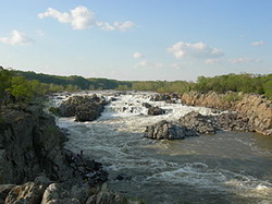
The Fall Line
The Fall Line is an area zone where the Piedmont meets the Coastal Plain, the Fall line is somewhat in the middle of Georgia based on its location.
The Fall Line is an area zone where the Piedmont meets the Coastal Plain, the Fall line is somewhat in the middle of Georgia based on its location.
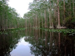
The Okefenokee Swamp
The Okefenokee Swamp is a swamp in the southern area of Georgia and is one of North America's most largest swamps. it is located in the Coastal Plain region.
The Okefenokee Swamp is a swamp in the southern area of Georgia and is one of North America's most largest swamps. it is located in the Coastal Plain region.
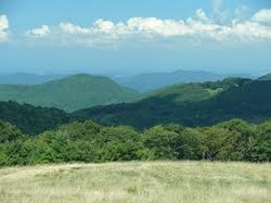
The Appalachian Mountains
The Appalachian Mountains are a chain of mountains that goes through Georgia's three northern regions. The highest mountain in the Appalachian Mountains is in the Appalachian Plateau, as it says in the name.
The Appalachian Mountains are a chain of mountains that goes through Georgia's three northern regions. The highest mountain in the Appalachian Mountains is in the Appalachian Plateau, as it says in the name.

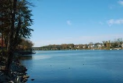
The Chattahoochee River
This river is a river that flows from the North Georgia mountains that goes south and empties out into the Gulf of Mexico. That goes quiet a distance to travel if you ask me.
This river is a river that flows from the North Georgia mountains that goes south and empties out into the Gulf of Mexico. That goes quiet a distance to travel if you ask me.
The Savannah River
This is a river that runs along Georgia's border with South Carolina.
This is a river that runs along Georgia's border with South Carolina.
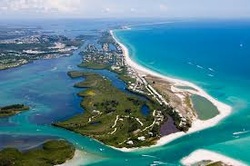
The Barrier Islands
These island that run through the bottom of Georgia are a chain of islands that goes on the Georgia coast.
